SuperMap iServer 服务器会对客户端 HTTP 请求做出响应,客户端执行 GET 请求,获得资源的表述,客户端执行 PUT、POST、DELETE 请求,获得操作结果的表述。表述可以有多种格式,如 html、xml、json、rjson、jsonp、png、bmp、gif 、jpg、jpeg、classic、leaflet、openlayers3、mapboxgl、tianditu 等,其中 png、bmp、gif、jpg 及 jpeg 是图片资源特有的表述格式,classic、leaflet、openlayers3、mapboxgl 及 tianditu 是 map 资源和 layer 资源支持的表述格式。
表述的格式在 HTTP 请求的 URI 中指定,形式是在 URI 后面加上.<format>。例如对 http://supermapiserver:8090/iserver/services/map-changchun/rest/maps.json 执行 GET 请求,就会返回 json 格式的 maps 资源的表述。
如果不指定<format>,SuperMap iServer 服务器以默认的表述格式返回相应表述,默认返回 html 格式的表述。
注意:获取图片资源的表述出错时,如果是 Debug 模式(在 AppContext.xml 中 REST 配置项的 debug 字段来设置,debug 为 true 表示为 Debug 模式,默认为 true),出错信息以 html 格式返回,否则以 json 格式返回。
目前,SuperMap iServer 支持的全部表述格式:
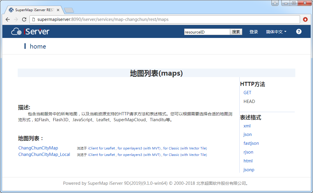
默认的非图片资源表述格式。返回一个 HTML 页面。HTML 可以容易地表达一个列表,而且可以用标准属性(class)表达列表的种类。
例如,要获得 maps 服务的 HTML 表述,可以用以下 URI:
http://supermapiserver:8090/iserver/services/map-changchun/rest/maps.html
因为 html 是默认的非图片资源表述格式,所以也可以不指定,直接使用如下 URI:
http://supermapiserver:8090/iserver/services/map-changchun/rest/maps
返回的示例如下所示:
<!DOCTYPE HTML PUBLIC "-//W3C//DTD HTML 4.01//EN" "http://www.w3.org/TR/html4/strict.dtd">
<html>
<head>
……
</head>
<body>
……
<div id="content" valign="top" width="80%">
<h1>地图列表(maps)</h1>
……
<b>描述:</b>
……
<b>地图列表:</b>
……
<span><strong>HTTP 方法</strong></span>
……
<span><strong>表述格式</strong></span>
……
</div>
</body>
</html>
在浏览器中显示如下:
返回一个 xml 格式的文档。SuperMap iServer 自定义了一系列 XML 词汇,这样就能够更准确地表述资源。
例如,要获得 maps 服务的 XML 表述,可以用以下 URI:
http://supermapiserver:8090/iserver/services/map-world/rest/maps.xml
返回的示例如下所示:
<?xml version="1.0" encoding="UTF-8" standalone="no"?>
<list>
<ChildResource>
<name>世界地图</name>
<resourceType>StaticResource</resourceType>
<resourceConfigID>map</resourceConfigID>
<path>http://localhost:8090/iserver/services/map-world/rest/maps/%E4%B8%96%E7%95%8C%E5%9C%B0%E5%9B%BE</path>
<supportedMediaTypes>
<string>application/xml</string>
<string>text/xml</string>
<string>application/json</string>
<string>application/rjson</string>
<string>text/html</string>
<string>application/jsonp</string>
<string>application/x-java-serialized-object</string>
<string>application/ajax</string>
<string>application/kml</string>
<string>application/ifx</string>
<string>application/flex</string>
<string>application/isl</string>
<string>application/silverlight</string>
<string>application/ijs</string>
<string>application/javascript</string>
<string>application/html5</string>
<string>application/smc</string>
<string>application/supermapcloud</string>
<string>application/tdt</string>
<string>application/tianditu</string>
<string>application/ilt</string>
<string>application/leaflet</string>
<string>application/flash3d</string>
</supportedMediaTypes>
</ChildResource>
</list>
返回一个 KML 格式的页面,当资源是 map、 features、 feature 时有效。 KML(Keyhole Markup Language)是 GoolgleEarth 的文件格式,是一个基于 XML 语法和文件格式的文件,用来描述和保存如点、线、图片、折线等地理信息要素并在 Google Earth、 Google Map 等应用系统中显示。
例如,要获得 features 服务的 KML 表述,可以用以下 URI:
http://supermapiserver:8090/iserver/services/data-changchun/rest/data/datasources/Changchun/datasets/Frame/features.kml
返回的示例如下所示:
<?xml version="1.0" encoding="utf-8" standalone="no"?>
<kml>
<Document>
<NetworkLink>
<name>0-1-0</name>
<Link>
<href>http://supermapiserver:8090/iserver/services/data-changchun/rest/data/feature/0-1-0.kml</href>
</Link>
</NetworkLink>
<NetworkLink>
<name>0-1-1</name>
<Link>
<href>http://supermapiserver:8090/iserver/services/data-changchun/rest/data/feature/0-1-1.kml</href>
</Link>
</NetworkLink>
</Document>
</kml>
要获得 map 服务的 KML 表述,可以用以下 URI:
http://supermapiserver:8090/iserver/services/map-changchun/rest/maps/长春市区图.kml
返回一个 GeoRSS 格式的页面,当资源是 features、feature 时有效。GeoRSS 是 OGC 在 GML(地理标记语言) 基础上推出的描述地理信息的规范,它使用 XML 语言存储和传输地理数据,用来描述和保存如点、线、面等地理信息要素。GeoRSS 提供了 GeoRSS Simple 和 GeoRSS GML Profile 两种形式,SuperMap iServer 目前支持 GeoRSS Simple 表述。GeoRSS 格式的地理要素信息可以通过 Virtual Earth 等应用系统显示。
例如,data-changchun/rest 服务中有一个名为 Park 的数据集,要获取其索引号为 0-0-0 的要素的 georss 表述,可以用以下 URI(有关 feature 资源的请求 URI,请参见 feature 资源介绍):
http://supermapiserver:8090/iserver/services/data-changchun/rest/data/feature/0-0-0.georss
返回的示例如下所示:
<?xml version="1.0" encoding="utf-8" standalone="no"?>
<rss xmlns:georss="http://www.georss.org/georss" version="2.0">
<channel>
<title>GeoRSS-Simple Representation for Feature Resource</title>
<link><![CDATA[http://supermapiserver:8090/iserver/services/data-changchun/rest/data/feature/0-0-0]]></link>
<item>
<title>朝阳公园</title>
<link><![CDATA[http://supermapiserver:8090/iserver/services/data-changchun/rest/data/feature/0-0-0]]></link>
<description><![CDATA[<table border='1'><tr><th colspan='9' scope='col'>朝阳公园</th></tr><tr><td>SMID</td><td>SMX</td><td>SMY</td><td>SMLIBTILEID</td><td>SMUSERID</td><td>SMGEOMETRYSIZE</td><td>NAME</td><td>X</td><td>Y</td></tr><tr><td>1</td><td>4597.873059</td><td>-4567.922216</td><td>1</td><td>0</td><td>16</td><td>朝阳公园</td><td>4597.873059</td><td>-4567.922216</td></tr></table>]]></description>
<georss:point>-4567.922216 4597.873059</georss:point>
</item>
</channel>
</rss>
返回一个 JSON 字符串。JSON(JavaScript Object Notation)是一种 JavaScript 对象表示法,是一种轻量级的数据交换格式,可以表达一般的数据结构。
例如,要获得 maps 资源的 JSON 表述,可以用以下 URI:
http://supermapiserver:8090/iserver/services/map-changchun/rest/maps.json
返回的示例如下所示:
[
{
"resourceConfigID": "map",
"name": "长春市区图",
"path": "http://localhost:8090/iserver/services/map-changchun/rest/maps/%E9%95%BF%E6%98%A5%E5%B8%82%E5%8C%BA%E5%9B%BE",
"supportedMediaTypes": [
"application/xml",
"text/xml",
"application/json",
"application/rjson",
"text/html",
"application/jsonp",
"application/x-java-serialized-object",
"application/ajax",
"application/kml",
"application/ifx",
"application/flex",
"application/isl",
"application/silverlight",
"application/ijs",
"application/javascript",
"application/html5",
"application/smc",
"application/supermapcloud",
"application/tdt",
"application/tianditu",
"application/ilt",
"application/leaflet",
"application/flash3d"
],
"resourceType": "StaticResource"
}
]
执行 PUT、POST、DELETE、HEAD 请求时默认的操作结果表述格式。返回一个格式化了的 JSON 字符串,更便于阅读。
例如,要获得 maps 服务的 RJSON 表述,可以用以下 URI:
http://supermapiserver:8090/iserver/services/map-changchun/rest/maps.rjson
返回的示例如下所示:
[{
"name": "长春市区图",
"path": "http://localhost:8090/iserver/services/map-changchun/rest/maps/%E9%95%BF%E6%98%A5%E5%B8%82%E5%8C%BA%E5%9B%BE",
"resourceConfigID": "map",
"resourceType": "StaticResource",
"supportedMediaTypes": [
"application/xml",
"text/xml",
"application/json",
"application/rjson",
"text/html",
"application/jsonp",
"application/x-java-serialized-object",
"application/ajax",
"application/kml",
"application/ifx",
"application/flex",
"application/isl",
"application/silverlight",
"application/ijs",
"application/javascript",
"application/html5",
"application/smc",
"application/supermapcloud",
"application/tdt",
"application/tianditu",
"application/ilt",
"application/leaflet",
"application/flash3d"
]
}]
JSONP(JSON with Padding)是 JSON 格式的一种补充,用于方便客户端实现跨域访问。
例如,要获得 maps 资源的 JSONP 表述,指定回调函数名为 mycallbackname,可以用以下 URI:
http://supermapiserver:8090/iserver/services/map-changchun/rest/maps.jsonp?callback=mycallbackname
返回的示例如下所示:
callBack11893434([{"resourceConfigID":"map","name":"长春市区图","path":"http://localhost:8090/iserver/services/map-changchun/rest/maps/%E9%95%BF%E6%98%A5%E5%B8%82%E5%8C%BA%E5%9B%BE","supportedMediaTypes":["application/xml","text/xml","application/json","application/rjson","text/html","application/jsonp","application/x-java-serialized-object","application/ajax","application/kml","application/ifx","application/flex","application/isl","application/silverlight","application/ijs","application/javascript","application/html5","application/smc","application/supermapcloud","application/tdt","application/tianditu","application/ilt","application/leaflet","application/flash3d"],"resourceType":"StaticResource"}],200)
返回请求的 PNG 格式图片,仅当资源是图片时有效。
例如,要获得名为长春市区图的地图的当前显示,格式为 PNG,可以用以下 URI:
http://supermapiserver:8090/iserver/services/map-changchun/rest/maps/长春市区图/image.png
返回请求的 bmp 格式图片,仅当资源是图片时有效。
例如,要获得名为 World 的地图的当前显示,格式为 BMP,可以用以下 URI:
http://supermapiserver:8090/iserver/services/map-changchun/rest/maps/长春市区图/image.bmp
返回请求的 GIF 格式图片,仅当资源是图片时有效。
例如,要获得名为长春市区图的地图的当前显示,格式为 GIF,可以用以下 URI:
http://supermapiserver:8090/iserver/services/map-changchun/rest/maps/长春市区图/image.gif
返回请求的 JPEG 格式图片,仅当资源是图片时有效。
例如,要获得名为长春市区图的地图的当前显示,格式为 JPEG(*.jpg),可以用以下 URI:
http://supermapiserver:8090/iserver/services/map-changchun/rest/maps/长春市区图/image.jpg
返回请求的 WebP 格式图片,仅当资源是图片时有效。WebP 是谷歌提出的一种既提供有损压缩也提供无损压缩的图片格式,WebP 无损压缩图片的大小小于相同图像质量的 PNG 格式的图像。目前地图服务的 image,tileImage,entireimage,overview,symbol,zxyTileImage 资源均支持通过 WebP 表述浏览。
例如,要获得名为长春市区图的地图的当前显示,格式为 WebP(*.webp),可以用以下 URI:
http://supermapiserver:8090/iserver/services/map-changchun/rest/maps/长春市区图/image.webp
注:在切图时,栅格、影像数据建议使用 WebP 格式,矢量数据建议使用 PNG 格式。
当资源是 map、layer 时 classic 表述有效。classic 表述是针对 JavaScript 客户端的应用,实现了简单的地图功能,如缩放、量算等。
例如,要获得名为 World Map 的地图的classic 表述,可以用以下 URI:
http://supermapiserver:8090/iserver/representations/classic/map.html?serviceName=map-World&mapName=World
当资源是 map、layer 时 tianditu 表述有效。 tianditu 表述是将当前地图与天地图的地图服务叠加显示,实现了简单的地图功能,如缩放、量算等。tianditu 表述可以通过 URI.tdt 或 URI.tianditu 形式获得。
例如,要获得名为 World Map 的地图的 tianditu 表述,可以用以下 URI:
http://supermapiserver:8090/iserver/services/map-world/rest/maps/World+Map.tdt
由于天地图的数据经过了脱密处理,tianditu 表述形式下,当前地图与天地图图层的叠加可能存在一定程度的偏差。
iServer 对平面坐标系的地图不提供 tianditu 表述,因为平面坐标系的地图无法与天地图的地图进行叠加。
对于地图模块的prjCoordSys资源,SuperMap iServer 提供了 WKT 表述用于表达当前地图坐标参考系统。WKT(Well-known Text)是 OGC(开放地理空间联盟)制定的一种文本标记语言,用于表示几何对象、坐标参考系统及坐标系之间的转换。
prjCoordSys资源的 WKT 表述用于表达当前地图的坐标参考系统,如:
http://supermapiserver:8090/iserver/services/map-world/rest/maps/世界地图/prjCoordSys.wkt
当资源是features、feature、featureResult、queryResult时,geojson表述有效。GeoJSON是基于JSON表示法的地理空间信息数据交换格式。
例如,要获得 World 数据服务中索引号为0-13-19的 feature 资源的 GeoJSON 表述,可以使用以下URI:
http://supermapiserver:8090/iserver/services/data-World/rest/data/feature/0-13-19.geojson
可获得名为0-13-19.geojson的文件,文件可用文本编辑器打开,内容示例如下:
{ "geometry":null,
"id":"20",
"type":
"Feature",
"properties": {
"SQKM":"48775.27",
"SMSDRIW":"16.84472",
"SMSDRIS":"47.7375",
"POP_1994":"5374362.0",
"SMSDRIN":"49.60083",
"SMID":"20",
"COUNTRY":"斯洛伐克",
"CONTINENT":"欧洲",
"SMAREA":"4.892668943085318E10",
"COLORID":"1",
"SMPERIMETER":"1207821.0411783515",
"SQMI":"18832.13",
"SMGEOMETRYSIZE":"3544",
"COLOR_MAP":"2",
"CAPITAL":"布拉迪斯拉发",
"SMSDRIE":"22.558052",
"SMUSERID":"23"
}
}
当资源是 map、layer 时 openlayers 表述有效。openlayers 表述是针对 JavaScript 客户端的应用,实现了简单的地图功能,如缩放、量算等。
例如,要获得名为 World Map 的地图的 openlayers 表述,可以用以下 URI:
http://supermapiserver:8090/iserver/representations/openlayers3/map.html?serviceName=map-World&mapName=World
当资源是 map、dataset 时 openlayers with MVT 表述有效。openlayers(with MVT) 表述是针对 JavaScript 客户端的应用,实现依照 Mapbox 矢量瓦片规范来浏览地图矢量要素。
例如,要获得名为 World Map 的地图的 openlayers with MVT 表述,可以用以下 URI:
http://supermapiserver:8090/iserver/openlayers3/map.html?serviceName=map-World&mapName=World&isMvt=true
当资源是 map 时 leaflet 表述有效。leaflet 表述是针对 JavaScript 客户端的应用,实现了简单的地图功能,如缩放、量算等。
例如,要获得名为 World Map 的地图的 leaflet 表述,可以用以下 URI:
http://supermapiserver:8090/iserver/representations/leaflet/map.html?serviceName=map-World&mapName=World
当资源是 map 时,且地图的投影坐标系为3857、4326、4490、4214、4610 时,mapboxgl 表述有效。mapboxgl 表述是针对 JavaScript 客户端的应用,实现了简单的地图功能,如缩放、量算等。mapboxgl 表述仅支持浏览地图矢量要素。
例如,要获得名为 China 的地图的 mapboxgl 表述,可以用以下 URI:
http://supermapiserver:8090/iserver/representations/mapboxgl/map.html?serviceName=map-World&mapName=World
当资源是 map,且地图不是平面坐标系时,WebGL3D 表述有效。WebGL3D实现了简单的三维地图功能,如缩放、旋转等。
例如,要获得名为 World 的地图的 WebGL3D 表述,可以用以下 URI:
http://supermapiserver:8090/iserver/representations/webgl3d/map.html?serviceName=map-World&mapName=World
当资源是 featureResults、featureResult、queryResults、queryResult、connectedEdges、traceDown、traceUp、geometryOverlayResult (geometry)、geometryBufferResult (geometry)、datasetBufferResult、datasetOverlayResult、datasetIsolineResult、datasetIsoregionResult、datasetThiessenPolygonResult、geometryBufferResult (spatialAnalyst)、geometryOverlayResult (spatialAnalyst)、geometryIsolineResult、 geometryIsoregionResult、 geometryThiessenPolygonResult 时,FlatGeobuf 表述有效。FlatGeobuf 是一种基于 flatbuffers,能容纳简单要素(Simple Features)规范下数据的二进制编码格式,具有文件较小,能够分段传输和局部加载的特点。FlatGeobuf 表述可以通过 URI.fgb 形式获得。
例如,要获得 World 数据服务中 Capitals 数据集 ID 为1-3 的要素查询结果的 FlatGeobuf 表述,可以用以下 URI:
http://supermapiserver:8090/iserver/services/data-World/rest/data/featureResults/d935257d1b284a3c9c187f65d8417b12_71377342b8b742deb45ea5fd4c58bf45.fgb
可获得名为 d935257d1b284a3c9c187f65d8417b12_71377342b8b742deb45ea5fd4c58bf45.fgb 的文件,可用 QGIS 等软件打开进行使用。