- java.lang.Object
-
- com.supermap.data.InternalHandle
-
- com.supermap.realspace.Layer3D
-
- com.supermap.realspace.Layer3DWMS
-
public class Layer3DWMS
extends Layer3D
WMS(网络地图服务)图层类,继承于Layer3D类型。该图层可以使 WMS(网络地图服务)在三维场景中直接显示,通过
Layer3Ds.add(String dataName, Layer3Dtype layerType, boolean addToHead)方法添加该类型图层到三维场景中,该方法需要传入三个参数,dataName 对应的是在发布WMS(网络地图服务)的网址;layerType 对应的是 WMS(网络地图服务)图层的类型,对于 WMS(网络地图服务)图层应当选择Layer3DType.WMS类型;addToHead 表示是否将新添加的三维图层加到最上面。
-
-
方法概要
所有方法 实例方法 具体方法 限定符和类型 方法和说明 String[]getAllSubLayers()返回 WMS(网络地图服务)所有的子图层的名称。ColorgetTransparentColor()返回透明色。intgetTransparentColorTolerance()返回透明色容限,容限范围是(0~255)。String[]getVisibleSubLayers()返回 WMS(网络地图服务)可见的子图层的名称。booleanisBackgroundTransparent()返回添加到三维场景中的 WMS(网络地图服务)的背景是否透明。booleanisRenderingWithMultiResolution()返回是否多分辨率渲染。booleanisTransparent()返回是否使透明色及其容限范围内的颜色透明显示。voidsetBackgroundTransparent(boolean value)设置添加到三维场景中的 WMS(网络地图服务)的背景是否透明。voidsetRenderingWithMultiResolution(boolean renderingWithMultiResolution)设置是否多分辨率渲染。voidsetTransparent(boolean transparent)设置是否使透明色及其容限范围内的颜色透明显示。voidsetTransparentColor(Color color)设置透明色。voidsetTransparentColorTolerance(int colorTolerance)设置透明色容限,容限范围是(0~255)。voidsetVisibleSubLayers(String[] subLayers)根据所传入的 WMS(网络地图服务)子图层的名称设置其可见。-
从类继承的方法 com.supermap.realspace.Layer3D
clearCustomClipPlane, clipByBox, fromXML, getAlphaReject, getBounds, getBoxClipPart, getCaption, getClipBox, getClipLineColor, getCustomClipCross, getCustomClipPlane, getDataName, getDescription, getEditFeature, getExtendXML, getFeatures, getFilterPixelSize, getMapServiceType, getMaxObjectVisibleDistance, getMaxVisibleAltitude, getMinObjectVisibleDistance, getMinVisibleAltitude, getMixColorType, getName, getParentGroup, getParentLayer, getPassword, getReceiveSunLight, getReleaseWhenInvisible, getSelection, getShdowType, getSnap, getSwipeRegion, getType, getVisibleDistance, getVisibleInViewport, hasLocalCache, isAlwaysRender, isChangedToLayerStyle, isDisposed, isEditable, isSelectable, isShadowEnable, isSketchMode, isSwipeEnable, isVertexColorLinear, isVisible, isWebDatasource, setAlphaReject, setAlwaysRender, setCaption, setChangedToLayerStyle, setClipLineColor, setCustomClipCross, setCustomClipPlane, setDescription, setEditable, setFilterPixelSize, setLocalCache, setMaxObjectVisibleDistance, setMaxVisibleAltitude, setMinObjectVisibleDistance, setMinVisibleAltitude, setMixColorType, setParentGroup, setParentLayer, setReceiveSunLight, setReleaseWhenInvisible, setSelectable, setSelection, setShadowEnable, setShadowType, setSkecthMode, setSketchMode, setSnap, setSwipeEnable, setSwipeRegion, setVertexColorLinear, setVisible, setVisibleDistance, setVisibleInViewport, toXML, updateData
-
-
-
-
方法详细资料
-
isTransparent
public boolean isTransparent()
返回是否使透明色及其容限范围内的颜色透明显示。- 返回:
- 是否使透明色及其容限范围内的颜色透明显示。
-
setTransparent
public void setTransparent(boolean transparent)
设置是否使透明色及其容限范围内的颜色透明显示。- 参数:
transparent- 是否使透明色及其容限范围内的颜色透明显示。
-
getTransparentColor
public Color getTransparentColor()
返回透明色。- 返回:
- 透明色。
-
setTransparentColor
public void setTransparentColor(Color color)
设置透明色。- 参数:
color- 透明色
-
getTransparentColorTolerance
public int getTransparentColorTolerance()
返回透明色容限,容限范围是(0~255)。- 返回:
- 透明色容限,容限范围是(0~255)。
-
setTransparentColorTolerance
public void setTransparentColorTolerance(int colorTolerance)
设置透明色容限,容限范围是(0~255)。- 参数:
colorTolerance- 透明色容限,容限范围是(0~255)。
-
isRenderingWithMultiResolution
public boolean isRenderingWithMultiResolution()
返回是否多分辨率渲染。- 返回:
- 一个布尔值,表示是否多分辨率渲染。
-
setRenderingWithMultiResolution
public void setRenderingWithMultiResolution(boolean renderingWithMultiResolution)
设置是否多分辨率渲染。- 参数:
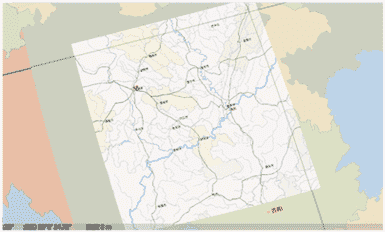
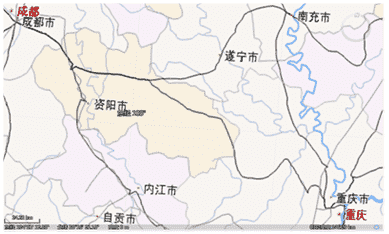
renderingWithMultiResolution- 是否多分辨率渲染。参数设置为 true 时,以多分辨率渲染,效果图如下:

参数设置为 false 时,以一种分辨率渲染,效果图如下:

-
isBackgroundTransparent
public boolean isBackgroundTransparent()
返回添加到三维场景中的 WMS(网络地图服务)的背景是否透明。- 返回:
- 一个布尔值,返回值为 true,表示 WMS(网络地图服务)背景透明,返回值为 false,表示不透明。
- 默认值:
- 默认值为 true,表示三维地图图层的背景透明。
-
setBackgroundTransparent
public void setBackgroundTransparent(boolean value)
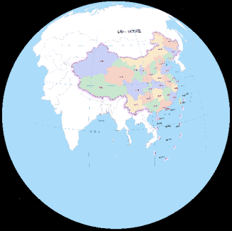
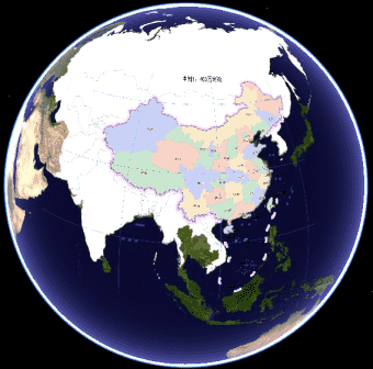
设置添加到三维场景中的 WMS(网络地图服务)的背景是否透明。为了地图的整体美观有时会设置地图背景色,将设置了背景色的 WMS(网络地图服务)添加到三维场景中时,半个三维球的范围都会被地图覆盖,如下图所示,等同于该方法设置 false 时的效果。

设置 WMS(网络地图服务)背景透明后,即该方法设置为 true 时,可以直观查看地图数据范围以外区域的三维球,使得在三维场景中有较好的视角效果,如下图所示。

- 参数:
value- 三维地图图层背景是否透明。
-
getAllSubLayers
public String[] getAllSubLayers()
返回 WMS(网络地图服务)所有的子图层的名称。
-
getVisibleSubLayers
public String[] getVisibleSubLayers()
返回 WMS(网络地图服务)可见的子图层的名称。- 返回:
- WMS(网络地图服务)可见的子图层的名称。
-
setVisibleSubLayers
public void setVisibleSubLayers(String[] subLayers)
根据所传入的 WMS(网络地图服务)子图层的名称设置其可见。- 参数:
subLayers- 所传入的 WMS(网络地图服务)子图层的名称数组。
-
-