Bentley export plug-in point + model function instructions and precautions
Background requirements
In the application of transportation, electric power and other industries, there is often such a type of data: the model itself is linear, with a narrow width and a long extension, and the model is composed of a few objects that are repeated continuously.
For example, railway tracks, transmission lines, etc. Using the conventional way of exporting the model will cause the result data set to expand rapidly, and the loading and browsing effect will be poor.
To this end, we propose a method of point + model to process such data.
Installation method
1. Copy DgnToUDB_S3MB.dgnlib to the following directory: C:\ProgramData\Bentley\MicroStationCONNECTEdition\Configuration\Organization\Dgnlib\Gui
2. Copy DgnToUDB_S3MB.dll and DgnToUDB_S3MB.ma to the Bentley installation directory.../Bentley/MicroStation CONNECT Edtion/MicroStation/Mdlapps;
3. Hypergraph component license is required;
4. Super Map Bin is a C++ component package, and the location is not limited; but it needs to be set as an environment variable and ensure that it is at the forefront of the path;
How to use
1. Export the data set in the form of point + model through the Bentley export plug-in
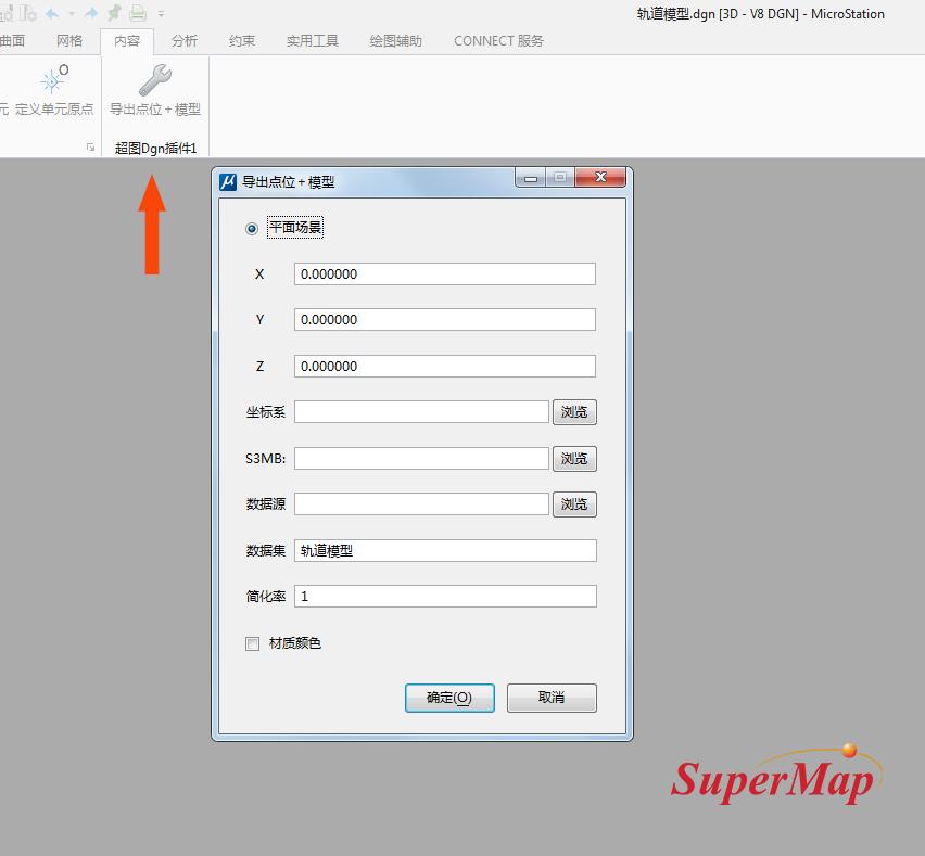
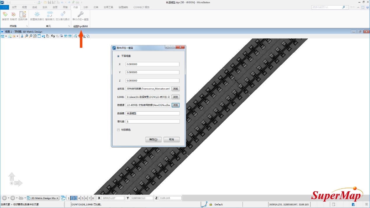
Open the model data through the MicroStation CONNECT software, in the menu bar - content module, click the "export point + model" icon under the SuperMap Dgn plug-in, and the plug-in export panel will pop up. The specific settings are as follows:
- ① Insertion point XYZ: In MicroStation CONNECT, whether an offset is set to the origin of the coordinate system, if not, keep the default value 0, 0, 0 unchanged; if yes, fill in the offset XYZ value here;
- ②How to view the offset value: In MicroStation CONNECT, under the Drawing Aids-ACS module, click the expand button in the lower right corner to pop up the management ACS panel, and you can view it.
- ③Coordinate system: If not set, it will be exported as a plane coordinate system by default. If a projected coordinate system is set, it will be exported in the set projected coordinate system;
- ④S3MB: storage location of plug-in objects;
- ⑤Data source: export the storage location of the data source, which contains a data set of three-dimensional points;
- ⑥Simplification rate: the degree of simplification of the model skeleton, the default value is 1, which can be simplified or refined according to the needs;
- ⑦Material color: By default, there is no need to check the material color. At this time, if the model has texture, the texture will be exported, and if there is no texture, the color will be exported. If you need to export the texture and color on the model at the same time, you need to check the material color.
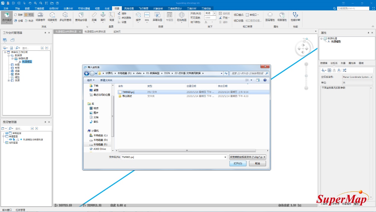
2. Modify the coordinate system in SuperMap iDesktop
If you have already set the coordinate system in step 1, you can skip this step and go to step 3 directly.
If you exported the plane coordinate data in step 1, you need to convert the coordinate system of the 3D point data set if you want to load the data to the spherical scene.
Select the data set, right-click the "Properties" button, and the properties window will pop up.
In the dataset properties window, select the "Import Coordinate System" function under "Coordinate System" to import the existing projected coordinate system file.
3. Generate cached data in SuperMap iDesktop
Select the 3D point data set, right-click "Browse Attribute Table" to view the properties, and you can see that the "Model Path", "Model Matrix" and other related information are recorded in it.
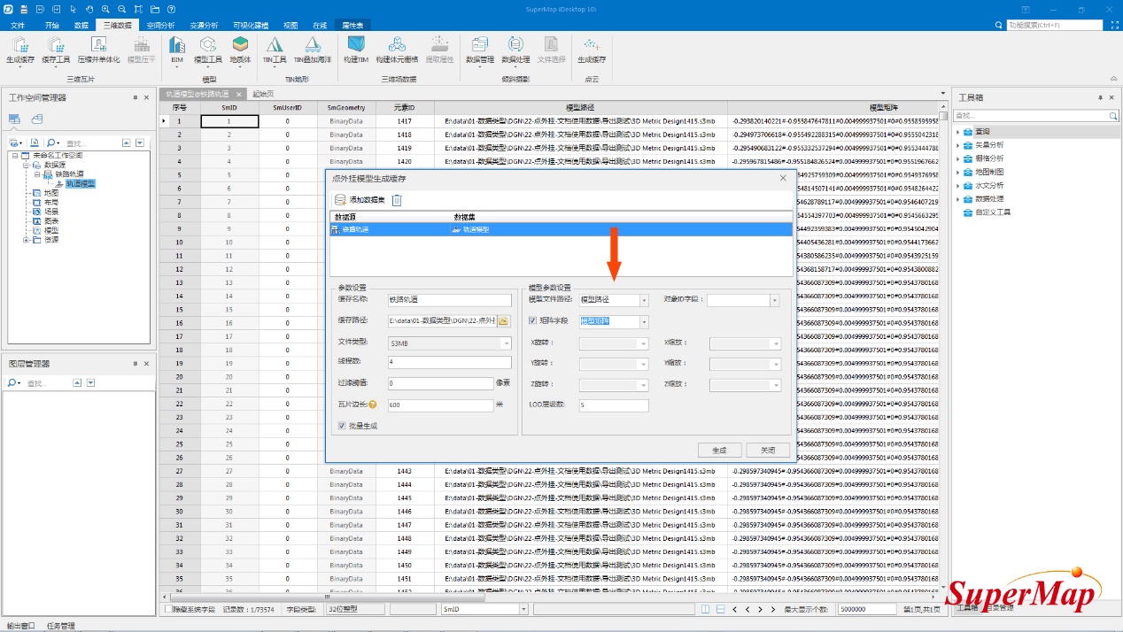
Click the "Point Set Generate Cache Plug-in Model" icon under the 3D data-3D tile-generate cache module, and the pop-up point plug-in generate cache window will pop up.
In the parameter settings, set the cache name, cache path and other parameters; in the model parameter settings, select the "model path" in the 3D point data set properties for the model file path, and select "model matrix" for the matrix field. After completion, Click the Generate button.
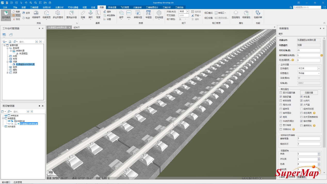
The final cache data loading effect is as follows:
Notes
1. When the 3D point data set is a plane coordinate system, the generated cache can only be loaded in the plane scene; when the 3D point data set is a projected coordinate system, the generated cache can only be loaded in the spherical scene; 3D point data The set cannot be a geographic coordinate system, otherwise the resulting cached data loading display will have a positional bias.
2. This method is only effective when there are a large number of shared objects in the data. If this is not the case, this method is not recommended.